Nation’s Capital Survives Flash Flooding Due To 1 to 4-inches of Rain
Aug 12, 2022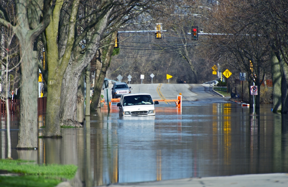
Lightning and torrential rains that began around 1 p.m. Wednesday, August 10th, resulted in flash flooding in the Washington, D.C. metropolitan area. The worst of it early on was west of the I-495, known in D.C. as the Beltway. Regions heavily hit included Loudoun County and Front Royal in Virginia. The storm then moved east carrying with it heavy rains and lightning. Early on there were no severe thunderstorms or flash flooding.
That changed by 4:30 p.m. on Wednesday. The storms were north and west of downtown Washington and residents of Fairfax County, Virginia experienced severe thunderstorms. Thunderstorm warnings were issued and were in effect through 5 p.m. in the northern and east central parts of the county.
By 5 p.m. heavy storms were soaking the entire region causing flooding in some locations. A flash flood warning was issued for parts of northern Virginia and a few areas were predicted to get up to 4-inches of rain. At least 1.5 to 2.5-inches of rain fell in parts of Washington and another inch or so was expected. Flash floods were occurring and more was expected.
A number of water rescues were performed in Prince George’s County in Maryland due to flooded streets that included US-1, sections of Riverdale Road, and flooding of numerous roads in upper Marlboro, Maryland. Many roads were impassable due to 3-feet of floodwaters.
Roadways that were closed included Rhode Island Avenue in Northeast Washington, Rock Creek Parkway, the 3rd Street tunnel between new York Avenue and I-395, Duke Street in Alexandria, Virginia, the Beltway near Good Luck Road in New Carrollton, and Central Avenue near the Beltway near Largo.
Residents of Tennessee had to contend with flooding. Reportedly, rescuers saved more than a dozen people trapped in rising floodwater at a campground Tuesday night.
There were reports that 14 people were reported trapped at the Greenbrier Campground in Gatlinburg, Tennessee. Water level of the flood was as high as a picnic table at one point. It swept away tents, other camping gear, and vehicles.
Waters began receding on Wednesday, August 10th.
A temporary evacuation center was created at the Pittman Center Elementary School in Gatlinburg to assist with residents who were displaced by flooding on the Little Pigeon River. The center expected to care for up to 100 people overnight on Wednesday.
Meanwhile, the National Hurricane Center was tracking a tropical disturbance off the southern coast of Louisiana. Forecasters predict that the storm will bring rain in Louisiana and Texas. According to the Hurricane Center, the system has a 10 percent chance of developing within the next five days. If it strengthens into a tropical storm, it will be issued the name Danielle.
The stormy weather caused power outages in Maryland, Virginia, North Carolina and Tennessee.
According to poweroutage.us, as of 4 pm on Thursday August 11, the worst of the outages occurred in:
- Virginia 4,481
- Maryland 2,168
- North Carolina 2,112
- Tennessee 1,379
No place in the country is immune to severe weather. And when Mother Nature strikes it makes sense to have a standalone generator to assure that your home is protected against power failures.
APElectric has a plethora of generators made by some of the most popular generator manufacturers in the country. The generators automatically provide energy instantaneously after a blackout occurs. Visit the company’s website for more information and to learn how to select the right generator for your particular situation.